Geolocate

Selva topographic map

Click on the map to display elevation.

About this map

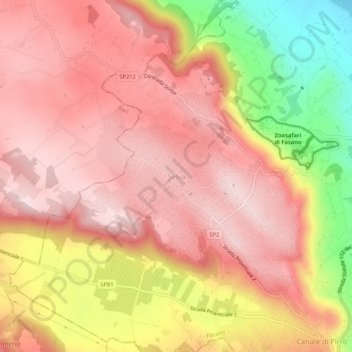
Name: Selva topographic map, elevation, terrain.

Location: Selva, Fasano, Brindisi, Apulia, 72015, Italy (40.80948 17.30052 40.84948 17.34052)

Average elevation: 1,020 ft

Minimum elevation: 331 ft

Maximum elevation: 1,355 ft

Gear up for your next adventure:

🔭Telescopic Hiking Pole - Adjustable pole for hiking stability
🏕️Tent Footprint - Protect your tent base from wear
🎒Day Hiking Backpack - Lightweight backpack perfect for day trips and outdoor adventures
🧯Emergency Survival Kit - All‑in‑one survival essentials for the backcountry
🛰️Handheld GPS Units - Professional satellite navigators for precise backcountry mapping

As an Amazon Associate, this site earns from qualifying purchases at no extra cost to you.