Geolocate

Buang topographic map

Click on the map to display elevation.

About this map

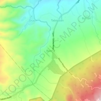
Name: Buang topographic map, elevation, terrain.

Location: Buang, Tabaco, Albay, Bicol Region, 4511, Philippines (13.29154 123.62173 13.33154 123.66173)

Average elevation: 820 ft

Minimum elevation: 315 ft

Maximum elevation: 1,667 ft

Other topographic maps

Click on a map to view its topography, its elevation and its terrain.

Gear up for your next adventure:

🧣Merino Neck Gaiters - Multi-functional headwear for wind and sun protection
🎒Outdoor Daypacks - Lightweight backpacks designed for carrying maps and essential gear
🧦Merino Wool Socks - Moisture-wicking, blister-preventing socks for long treks
🧭Pro Hiking Compasses - High-accuracy liquid-filled compasses for topographic orientation
🪶Camping Sleeping Pad - Comfortable sleeping pad for backpacking

As an Amazon Associate, this site earns from qualifying purchases at no extra cost to you.