Geolocate

Taft topographic map

Click on the map to display elevation.

About this map

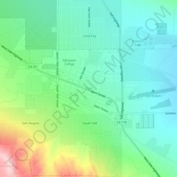
Name: Taft topographic map, elevation, terrain.

Location: Taft, Kern County, California, 93268, United States (35.12247 -119.47651 35.16247 -119.43651)

Average elevation: 988 ft

Minimum elevation: 751 ft

Maximum elevation: 1,591 ft

Kern County trails, hiking, mountain biking, running and outdoor activities

Gear up for your next adventure:

🥇GPS Hiking Watch - Multi‑sport GPS watch with navigation and trail tracking
☀️Outdoor Sunscreen - High protection sunscreen for outdoor activities
🪶Survival Guide Book - Expert advice for emergency preparedness
🧭Hiking Compass - Precision compass for reliable navigation in the wilderness
🔌USB Car Charger - Car charger for on‑the‑go power needs

As an Amazon Associate, this site earns from qualifying purchases at no extra cost to you.