Geolocate

Gambrills topographic map

Click on the map to display elevation.

About this map

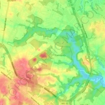
Name: Gambrills topographic map, elevation, terrain.

Location: Gambrills, Anne Arundel County, Maryland, United States (39.06486 -76.68558 39.12802 -76.62498)

Average elevation: 121 ft

Minimum elevation: -3 ft

Maximum elevation: 256 ft

Anne Arundel County trails, hiking, mountain biking, running and outdoor activities

Gear up for your next adventure:

🩳Quick‑Dry Hiking Shorts - Comfortable and quick‑dry shorts for summer hiking
📷Action Cameras - Rugged cameras to document your journeys across rugged terrain
🧭Outdoor Navigation Book - Learn advanced navigation skills
🪶Compact Camp Shovel - Folding shovel for campsite tasks
🧭Hiking Compass - Precision compass for reliable navigation in the wilderness

As an Amazon Associate, this site earns from qualifying purchases at no extra cost to you.