
Thank you for supporting this site ❤️
Make a donation
Make a donation
Gear up for your next adventure:
As an Amazon Associate, this site earns from qualifying purchases at no extra cost to you.
Pesquera topographic map
Click on the map to display elevation.
Thank you for supporting this site ❤️
Make a donation
Make a donation
Gear up for your next adventure:
As an Amazon Associate, this site earns from qualifying purchases at no extra cost to you.
About this map
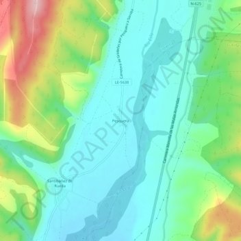
Name: Pesquera topographic map, elevation, terrain.
Location: Pesquera, Cistierna, León, Castilla y León, España (42.71075 -5.17660 42.75075 -5.13660)
Average elevation: 3,107 ft
Minimum elevation: 2,917 ft
Maximum elevation: 3,596 ft
Thank you for supporting this site ❤️
Make a donation
Make a donation
Gear up for your next adventure:
As an Amazon Associate, this site earns from qualifying purchases at no extra cost to you.