Geolocate

Positano topographic map

Click on the map to display elevation.

About this map

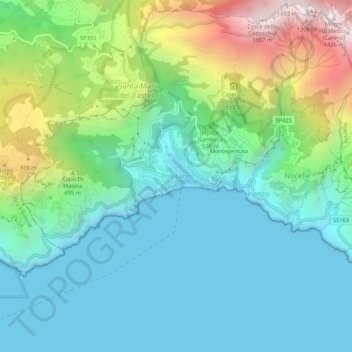
Name: Positano topographic map, elevation, terrain.

Location: Positano, Salerno, Campania, 84017, Italy (40.60866 14.46550 40.64866 14.50550)

Average elevation: 1,207 ft

Minimum elevation: -3 ft

Maximum elevation: 4,593 ft

Gear up for your next adventure:

🪶Thermal Camp Blanket - Extra warmth for cold nights
🥤Water Filter Bottle - All‑in‑one filter bottle for safe hydration
Backpacking Tents - Weight-optimized shelters for multi-day topographic surveys
🩹Survival Bandages - High‑quality bandages for emergencies
🪑Portable Camp Table - Compact table for campsite meals

As an Amazon Associate, this site earns from qualifying purchases at no extra cost to you.