
Thank you for supporting this site ❤️
Make a donation
Make a donation
Gear up for your next adventure:
As an Amazon Associate, this site earns from qualifying purchases at no extra cost to you.
Yhovy topographic map
Click on the map to display elevation.
Thank you for supporting this site ❤️
Make a donation
Make a donation
Gear up for your next adventure:
As an Amazon Associate, this site earns from qualifying purchases at no extra cost to you.
About this map
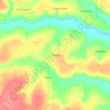
Name: Yhovy topographic map, elevation, terrain.
Location: Yhovy, Caaguazú, Región Oriental, Paraguay (-25.24228 -55.72390 -25.16228 -55.64390)
Average elevation: 866 ft
Minimum elevation: 738 ft
Maximum elevation: 997 ft
Thank you for supporting this site ❤️
Make a donation
Make a donation
Gear up for your next adventure:
As an Amazon Associate, this site earns from qualifying purchases at no extra cost to you.