Geolocate

Biga topographic map

Click on the map to display elevation.

About this map

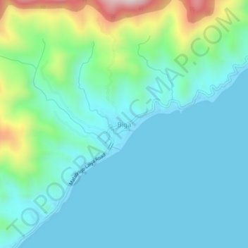
Name: Biga topographic map, elevation, terrain.

Location: Biga, Lobo, Batangas, Calabarzon, Philippines (13.62242 121.31346 13.66242 121.35346)

Average elevation: 407 ft

Minimum elevation: 0 ft

Maximum elevation: 2,014 ft

Gear up for your next adventure:

🪑Ultralight Camp Chairs - Portable seating for resting after a long day of mapping
🔥Fast-Boil Camping Stoves - Efficient cooking systems for quick trail meals
🥾Men's Hiking Boots - Durable, waterproof footwear for rugged terrain and steep inclines
🧺Microfiber Travel Towels - Compact and fast-drying towels for trail use
🌡️Portable Weather Meter - Track weather conditions on the trail

As an Amazon Associate, this site earns from qualifying purchases at no extra cost to you.