Geolocate

Alcadesma topographic map

Click on the map to display elevation.

About this map

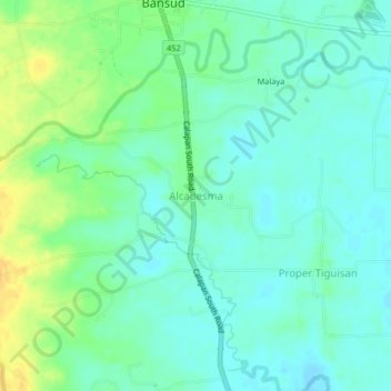
Name: Alcadesma topographic map, elevation, terrain.

Location: Alcadesma, Oriental Mindoro, Mimaropa, Philippines (12.81941 121.44052 12.85941 121.48052)

Average elevation: 46 ft

Minimum elevation: 16 ft

Maximum elevation: 105 ft

Gear up for your next adventure:

📱Solar Portable Charger - Solar power bank for charging devices off‑grid
🏥Hiking First Aid Kits - Comprehensive medical kits for remote trail injuries
📶Satellite Messenger - Communication device off‑grid
💧Water Purification System - Clean water on the trail with reliable purifiers
🎒Trail Energy Bars - High‑calorie bars for hiking energy

As an Amazon Associate, this site earns from qualifying purchases at no extra cost to you.