Geolocate

Bertram topographic map

Click on the map to display elevation.

About this map

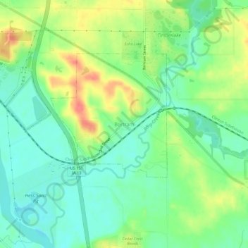
Name: Bertram topographic map, elevation, terrain.

Location: Bertram, Linn County, Iowa, United States (41.93010 -91.55519 41.97010 -91.51519)

Average elevation: 758 ft

Minimum elevation: 679 ft

Maximum elevation: 886 ft

Linn County trails, hiking, mountain biking, running and outdoor activities

Gear up for your next adventure:

🔥Camping Stove - Portable stove for camping and backcountry cooking
🔭Telescopic Hiking Pole - Adjustable pole for hiking stability
🪶LED Camping Lantern - Bright lantern for camp lighting
🛶Inflatable Kayak - Portable kayak for rivers, lakes, and expeditions
🎒Gear Packing Cubes - Organize your backpack efficiently

As an Amazon Associate, this site earns from qualifying purchases at no extra cost to you.