
Thank you for supporting this site ❤️
Make a donation
Make a donation
Gear up for your next adventure:
As an Amazon Associate, this site earns from qualifying purchases at no extra cost to you.
An Ses topographic map
Click on the map to display elevation.
Thank you for supporting this site ❤️
Make a donation
Make a donation
Gear up for your next adventure:
As an Amazon Associate, this site earns from qualifying purchases at no extra cost to you.
About this map
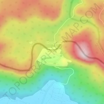
Name: An Ses topographic map, elevation, terrain.
Location: An Ses, Choam Ksant, Preah Vihear, Cambodia (14.36820 104.94460 14.40820 104.98460)
Average elevation: 1,165 ft
Minimum elevation: 318 ft
Maximum elevation: 2,119 ft
Thank you for supporting this site ❤️
Make a donation
Make a donation
Gear up for your next adventure:
As an Amazon Associate, this site earns from qualifying purchases at no extra cost to you.