Geolocate

Kambaa topographic map

Click on the map to display elevation.

About this map

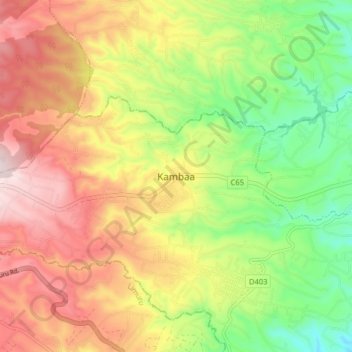
Name: Kambaa topographic map, elevation, terrain.

Location: Kambaa, Githiga ward, Githunguri, Kiambu, Kenya (-1.10234 36.68121 -1.02234 36.76121)

Average elevation: 6,939 ft

Minimum elevation: 6,178 ft

Maximum elevation: 7,740 ft

Gear up for your next adventure:

🥾Men's Hiking Boots - Durable, waterproof footwear for rugged terrain and steep inclines
📡Handheld GPS Device - Reliable handheld GPS for outdoor navigation
🧥Men's Rain Shells - Premium waterproof and breathable jackets for mountain weather
🏕️Tent Footprint - Protect your tent base from wear
🧭Pro Hiking Compasses - High-accuracy liquid-filled compasses for topographic orientation

As an Amazon Associate, this site earns from qualifying purchases at no extra cost to you.