
Hann. Münden topographic map
Interactive map
Click on the map to display elevation.
Hann. Münden
Geografische Daten der Stadt Hann. Münden – sortiert nach Höhen in Meter (m) über Normalhöhennull (NHN).
About this map
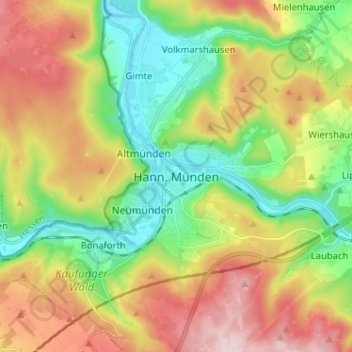
Name: Hann. Münden topographic map, elevation, terrain.
Average elevation: 837 ft
Minimum elevation: 377 ft
Maximum elevation: 1,470 ft