
Melrose topographic map
Click on the map to display elevation.
About this map
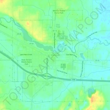
Name: Melrose topographic map, elevation, terrain.
Location: Melrose, Stearns County, Minnesota, United States (45.65792 -94.84498 45.69148 -94.78836)
Average elevation: 1,207 ft
Minimum elevation: 1,171 ft
Maximum elevation: 1,280 ft
Stearns County trails, hiking, mountain biking, running and outdoor activities