
Agdash District topographic map
Click on the map to display elevation.
About this map
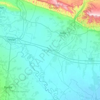
Name: Agdash District topographic map, elevation, terrain.
Location: Agdash District, Central Aran, Azerbaijan (40.31953 47.20891 40.80063 47.62832)
Average elevation: 213 ft
Minimum elevation: -13 ft
Maximum elevation: 2,182 ft
Other topographic maps
Click on a map to view its topography, its elevation and its terrain.