
Whitman Mission National Historic Site topographic map
Interactive map
Click on the map to display elevation.
About this map
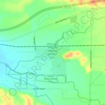
Name: Whitman Mission National Historic Site topographic map, elevation, terrain.
Average elevation: 643 ft
Minimum elevation: 587 ft
Maximum elevation: 735 ft
Walla Walla County trails, hiking, mountain biking, running and outdoor activities
Other topographic maps
Click on a map to view its topography, its elevation and its terrain.
Walla Walla
United States > Washington > Walla Walla County
Walla Walla County features a varied topography characterized by rolling hills, valleys, and river systems. The elevation in the area averages around 940 feet (approximately 287 meters) above sea level, with some areas rising to nearly 1,200 feet. The landscape is shaped by the Walla Walla River, which carves…
Average elevation: 974 ft