Geolocate

Bryans Road topographic map

Click on the map to display elevation.

About this map

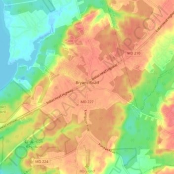
Name: Bryans Road topographic map, elevation, terrain.

Location: Bryans Road, Charles County, Maryland, 20616, United States (38.59341 -77.13155 38.65724 -77.04904)

Average elevation: 105 ft

Minimum elevation: -10 ft

Maximum elevation: 200 ft

Gear up for your next adventure:

🛰️Satellite Messengers - Emergency SOS and two-way messaging for off-grid adventures
🎒Outdoor Daypacks - Lightweight backpacks designed for carrying maps and essential gear
🧥Waterproof Jacket for Hiking - Breathable and rugged rain jacket for outdoor excursions
🗃️Trail First Aid Kit - Essential kit for outdoor injuries and emergencies
📷Action Cameras - Rugged cameras to document your journeys across rugged terrain

As an Amazon Associate, this site earns from qualifying purchases at no extra cost to you.