
Thank you for supporting this site ❤️
Make a donation
Make a donation
Gear up for your next adventure:
As an Amazon Associate, this site earns from qualifying purchases at no extra cost to you.
Fiães topographic map
Click on the map to display elevation.
Thank you for supporting this site ❤️
Make a donation
Make a donation
Gear up for your next adventure:
As an Amazon Associate, this site earns from qualifying purchases at no extra cost to you.
About this map
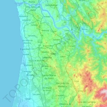
Name: Fiães topographic map, elevation, terrain.
Location: Fiães, Santa Maria da Feira, Aveiro, Norte, 4505-249, Portugal (40.83459 -8.68472 41.15459 -8.36472)
Average elevation: 486 ft
Minimum elevation: -3 ft
Maximum elevation: 2,900 ft
Thank you for supporting this site ❤️
Make a donation
Make a donation
Gear up for your next adventure:
As an Amazon Associate, this site earns from qualifying purchases at no extra cost to you.