
Prior Lake topographic map
Click on the map to display elevation.
Prior Lake
The eastern portion of Spring Lake along Scott County Road 12 is also located within the City of Prior Lake. Spring Lake, with 290 acres, but being a few minutes further out from the metro area offers similar recreational opportunities as Upper Prior Lake with a more rural character and less traffic. Spring Lake, being several feet higher in elevation, flows north, into Upper Prior Lake via a non-navigable spillway and culvert under County Road 12.
About this map
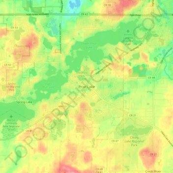
Name: Prior Lake topographic map, elevation, terrain.
Location: Prior Lake, Scott County, Minnesota, 55372, United States (44.67333 -93.46269 44.75333 -93.38269)
Average elevation: 948 ft
Minimum elevation: 810 ft
Maximum elevation: 1,086 ft
Scott County trails, hiking, mountain biking, running and outdoor activities