
鹿頸村 topographic map
Interactive map
Click on the map to display elevation.
About this map
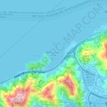
Name: 鹿頸村 topographic map, elevation, terrain.
Location: 鹿頸村, 荃灣區, 新界, 香港, 中国 (22.31178 114.00301 22.35178 114.04301)
Average elevation: 138 ft
Minimum elevation: -13 ft
Maximum elevation: 932 ft
Other topographic maps
Click on a map to view its topography, its elevation and its terrain.