
Thank you for supporting this site ❤️
Make a donation
Make a donation
Gear up for your next adventure:
As an Amazon Associate, this site earns from qualifying purchases at no extra cost to you.
Crasto topographic map
Click on the map to display elevation.
Thank you for supporting this site ❤️
Make a donation
Make a donation
Gear up for your next adventure:
As an Amazon Associate, this site earns from qualifying purchases at no extra cost to you.
About this map
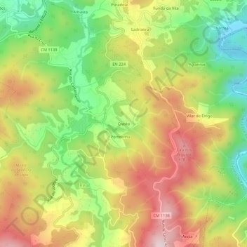
Name: Crasto topographic map, elevation, terrain.
Location: Crasto, Real, Castelo de Paiva, Aveiro, 4550-652, Portugal (40.99286 -8.28143 41.03286 -8.24143)
Average elevation: 892 ft
Minimum elevation: 128 ft
Maximum elevation: 1,709 ft
Thank you for supporting this site ❤️
Make a donation
Make a donation
Gear up for your next adventure:
As an Amazon Associate, this site earns from qualifying purchases at no extra cost to you.