
Thank you for supporting this site ❤️
Make a donation
Make a donation
Gear up for your next adventure:
As an Amazon Associate, this site earns from qualifying purchases at no extra cost to you.
Allmendhubel topographic map
Click on the map to display elevation.
Thank you for supporting this site ❤️
Make a donation
Make a donation
Gear up for your next adventure:
As an Amazon Associate, this site earns from qualifying purchases at no extra cost to you.
About this map
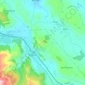
Name: Allmendhubel topographic map, elevation, terrain.
Location: Allmendhubel, Allmend, Menznau, Lucerne, 6122, Switzerland (47.07653 8.03536 47.09653 8.05536)
Average elevation: 2,087 ft
Minimum elevation: 1,880 ft
Maximum elevation: 2,753 ft
Thank you for supporting this site ❤️
Make a donation
Make a donation
Gear up for your next adventure:
As an Amazon Associate, this site earns from qualifying purchases at no extra cost to you.