
Lunana Gewogs topographic map
Interactive map
Click on the map to display elevation.
About this map
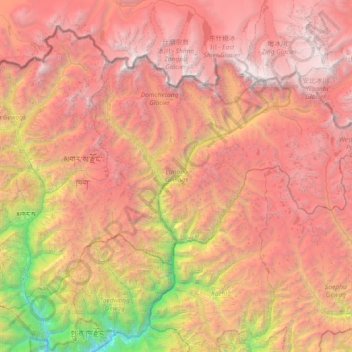
Name: Lunana Gewogs topographic map, elevation, terrain.
Location: Lunana Gewogs, Gasa District, Bhutan (27.75132 89.72654 28.19456 90.45540)
Average elevation: 14,925 ft
Minimum elevation: 4,472 ft
Maximum elevation: 23,406 ft
Other topographic maps
Click on a map to view its topography, its elevation and its terrain.