Geolocate

Karben topographic map

Click on the map to display elevation.

About this map

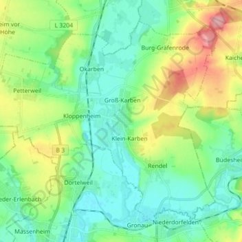
Name: Karben topographic map, elevation, terrain.

Location: Karben, Wetteraukreis, Hesse, 61184, Germany (50.19448 8.68845 50.26796 8.82727)

Average elevation: 463 ft

Minimum elevation: 344 ft

Maximum elevation: 722 ft

Gear up for your next adventure:

🛰️Handheld GPS Units - Professional satellite navigators for precise backcountry mapping
👟Trail Running Shoes - Lightweight shoes for trail runners
🧯Portable Fire Pit - Compact fire pit for camping spots
🗺️NatGeo Topo Maps - High-quality waterproof printed topographic maps of US Parks
🩳Quick‑Dry Hiking Shorts - Comfortable and quick‑dry shorts for summer hiking

As an Amazon Associate, this site earns from qualifying purchases at no extra cost to you.