

Make a donation
Gear up for your next adventure:
As an Amazon Associate, this site earns from qualifying purchases at no extra cost to you.
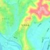
田家庵 topographic map
Click on the map to display elevation.
Make a donation
Gear up for your next adventure:
As an Amazon Associate, this site earns from qualifying purchases at no extra cost to you.
About this map

Name: 田家庵 topographic map, elevation, terrain.
Location: 田家庵, 绵阳市, 四川省, 中国 (31.42047 104.26781 31.46047 104.30781)
Average elevation: 1,982 ft
Minimum elevation: 1,923 ft
Maximum elevation: 2,070 ft
Make a donation
Gear up for your next adventure:
As an Amazon Associate, this site earns from qualifying purchases at no extra cost to you.
Other topographic maps
Click on a map to view its topography, its elevation and its terrain.
江油市
江油市是中华人民共和国四川省下辖的县级市,由绵阳市代管。江油位于四川盆地西北部,长江支流涪江的上游,以丘陵和平原地形为主,天然气资源丰富,水网交错,有总人口88万,其中城区常住人口35万。江油在新石器时期便存在人类活动,历史悠久,境内的青莲镇据称是唐代诗人李白的故乡。中华人民共和国建立后,江油曾作为三线建设基地建设了大量重工业和军工企业,是四川重要的重工业基地,拥有长城特殊钢集团、中国石油川西北气矿、中国燃气涡轮研究院(624院)、四川材料与工艺研究所(903所)等企业。此外,江油第三产业亦在21世纪得到了长足发展,2017年江油市GDP超过380亿人民币。
Average elevation: 2,917 ft
Make a donation
Gear up for your next adventure:
As an Amazon Associate, this site earns from qualifying purchases at no extra cost to you.
Make a donation
Gear up for your next adventure:
As an Amazon Associate, this site earns from qualifying purchases at no extra cost to you.


Make a donation
Gear up for your next adventure:
As an Amazon Associate, this site earns from qualifying purchases at no extra cost to you.


