
Thank you for supporting this site ❤️
Make a donation
Make a donation
Gear up for your next adventure:
As an Amazon Associate, this site earns from qualifying purchases at no extra cost to you.
Luoyang Subdistrict topographic map
Click on the map to display elevation.
Thank you for supporting this site ❤️
Make a donation
Make a donation
Gear up for your next adventure:
As an Amazon Associate, this site earns from qualifying purchases at no extra cost to you.
About this map
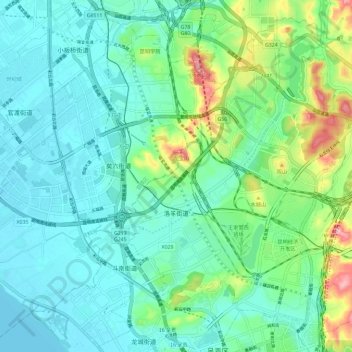
Name: Luoyang Subdistrict topographic map, elevation, terrain.
Location: Luoyang Subdistrict, Chenggong District, Yunnan, China (24.89351 102.79061 24.98800 102.90659)
Average elevation: 6,322 ft
Minimum elevation: 6,188 ft
Maximum elevation: 6,788 ft
Thank you for supporting this site ❤️
Make a donation
Make a donation
Gear up for your next adventure:
As an Amazon Associate, this site earns from qualifying purchases at no extra cost to you.