
Thank you for supporting this site ❤️
Make a donation
Make a donation
Gear up for your next adventure:
As an Amazon Associate, this site earns from qualifying purchases at no extra cost to you.
Gaustatoppen topographic map
Click on the map to display elevation.
Thank you for supporting this site ❤️
Make a donation
Make a donation
Gear up for your next adventure:
As an Amazon Associate, this site earns from qualifying purchases at no extra cost to you.
About this map
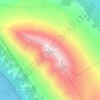
Name: Gaustatoppen topographic map, elevation, terrain.
Location: Gaustatoppen, Tinn, Vestfold og Telemark, 3660, Norway (59.85419 8.64905 59.85429 8.64915)
Average elevation: 4,462 ft
Minimum elevation: 2,956 ft
Maximum elevation: 6,129 ft
Thank you for supporting this site ❤️
Make a donation
Make a donation
Gear up for your next adventure:
As an Amazon Associate, this site earns from qualifying purchases at no extra cost to you.