

Thisted topographic map
Click on the map to display elevation.
Thisted
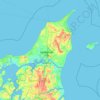
Thisted ligger på tre højdedrag eller byhøje, delt af to vandløb ned mod Limfjorden. Fra sydvest hæver det første højdedrag sig med Simons bakke, med bydelene Silstrup, Dragsbæk og Tilsted. Disse bydele afgrænses fra centrum af den lille Tilsted Å, "Dragsbækken". På den anden side af åen hæver den dominerende bydel sig, selve det centrale højdedrag, som en langstrakt ås fra Torp og Tingstrup i Vestbyen ned mod byens centrum ved Limfjorden, og den bærer bykernen og hele den gamle købstad ned mod havnen. Lidt øst for byens centrum løber Skinnerup Å, inden den nordøstlige og tredje bydel hæver sig med bydelene Østerbakken, Lerpytter, Fårtoft og Rolighed, i daglig tale Østbyen.
About this map
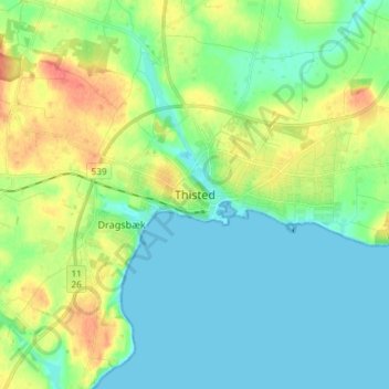
Name: Thisted topographic map, elevation, terrain.
Location: Thisted, Thisted Kommune, Region Nordjylland, Danmark (56.91621 8.64487 56.99621 8.72487)
Average elevation: 56 ft
Minimum elevation: -7 ft
Maximum elevation: 180 ft
Other topographic maps
Click on a map to view its topography, its elevation and its terrain.











Egholm
Danmark > Region Nordjylland > Aalborg
Egholm er i dag fuldstændig flad, højeste punkt er 1,5 meter over havoverfladen. Den lave højde gør øen sårbar over for stormflod. Man har derfor forsøgt at beskytte øen med diger. Det første dige blev bygget i 1909, og i dag er størstedelen af øen inddæmmet. Alligevel blev en del af øen…
Average elevation: 3 ft


