
Thank you for supporting this site ❤️
Make a donation
Make a donation
Gear up for your next adventure:
As an Amazon Associate, this site earns from qualifying purchases at no extra cost to you.
Nomuka topographic map
Click on the map to display elevation.
Thank you for supporting this site ❤️
Make a donation
Make a donation
Gear up for your next adventure:
As an Amazon Associate, this site earns from qualifying purchases at no extra cost to you.
About this map
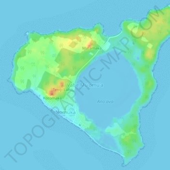
Name: Nomuka topographic map, elevation, terrain.
Location: Nomuka, Vahe Mu'omu'a, Haʻapai, Tonga (-20.27129 -174.81052 -20.23770 -174.77317)
Average elevation: 16 ft
Minimum elevation: -23 ft
Maximum elevation: 131 ft
Thank you for supporting this site ❤️
Make a donation
Make a donation
Gear up for your next adventure:
As an Amazon Associate, this site earns from qualifying purchases at no extra cost to you.