
Thank you for supporting this site ❤️
Make a donation
Make a donation
Gear up for your next adventure:
As an Amazon Associate, this site earns from qualifying purchases at no extra cost to you.
Grüna topographic map
Click on the map to display elevation.
Thank you for supporting this site ❤️
Make a donation
Make a donation
Gear up for your next adventure:
As an Amazon Associate, this site earns from qualifying purchases at no extra cost to you.
About this map
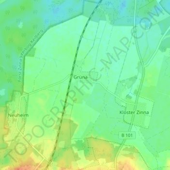
Name: Grüna topographic map, elevation, terrain.
Location: Grüna, Jüterbog, Teltow-Fläming, Brandenburg, Deutschland (52.00845 13.06391 52.04977 13.10113)
Average elevation: 223 ft
Minimum elevation: 180 ft
Maximum elevation: 299 ft
Thank you for supporting this site ❤️
Make a donation
Make a donation
Gear up for your next adventure:
As an Amazon Associate, this site earns from qualifying purchases at no extra cost to you.