
Thank you for supporting this site ❤️
Make a donation
Make a donation
Gear up for your next adventure:
As an Amazon Associate, this site earns from qualifying purchases at no extra cost to you.
Obernau topographic map
Click on the map to display elevation.
Thank you for supporting this site ❤️
Make a donation
Make a donation
Gear up for your next adventure:
As an Amazon Associate, this site earns from qualifying purchases at no extra cost to you.
About this map
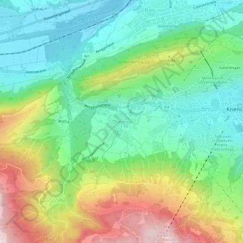
Name: Obernau topographic map, elevation, terrain.
Location: Obernau, Kriens, Luzern, 6012, Schweiz (47.01210 8.23359 47.05210 8.27359)
Average elevation: 2,152 ft
Minimum elevation: 1,486 ft
Maximum elevation: 3,412 ft
Thank you for supporting this site ❤️
Make a donation
Make a donation
Gear up for your next adventure:
As an Amazon Associate, this site earns from qualifying purchases at no extra cost to you.