
Thank you for supporting this site ❤️
Make a donation
Make a donation
Gear up for your next adventure:
As an Amazon Associate, this site earns from qualifying purchases at no extra cost to you.
Khemisti topographic map
Click on the map to display elevation.
Thank you for supporting this site ❤️
Make a donation
Make a donation
Gear up for your next adventure:
As an Amazon Associate, this site earns from qualifying purchases at no extra cost to you.
About this map
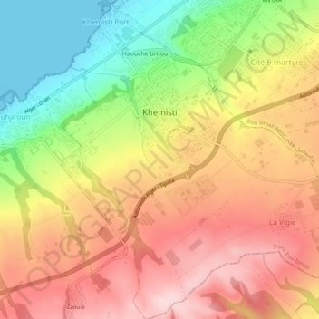
Name: Khemisti topographic map, elevation, terrain.
Location: Khemisti, Bou Ismail District, Tipaza, 42016, Algeria (36.60024 2.66478 36.63895 2.71241)
Average elevation: 482 ft
Minimum elevation: -7 ft
Maximum elevation: 879 ft
Thank you for supporting this site ❤️
Make a donation
Make a donation
Gear up for your next adventure:
As an Amazon Associate, this site earns from qualifying purchases at no extra cost to you.