
Thank you for supporting this site ❤️
Make a donation
Make a donation
Gear up for your next adventure:
As an Amazon Associate, this site earns from qualifying purchases at no extra cost to you.
Denny topographic map
Click on the map to display elevation.
Thank you for supporting this site ❤️
Make a donation
Make a donation
Gear up for your next adventure:
As an Amazon Associate, this site earns from qualifying purchases at no extra cost to you.
About this map
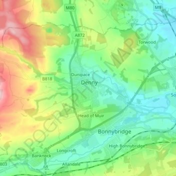
Name: Denny topographic map, elevation, terrain.
Location: Denny, Falkirk, Scotland, FK6 6EL, United Kingdom (55.98374 -3.94820 56.06374 -3.86820)
Average elevation: 282 ft
Minimum elevation: 33 ft
Maximum elevation: 830 ft
Thank you for supporting this site ❤️
Make a donation
Make a donation
Gear up for your next adventure:
As an Amazon Associate, this site earns from qualifying purchases at no extra cost to you.