
Make a donation
Gear up for your next adventure:
As an Amazon Associate, this site earns from qualifying purchases at no extra cost to you.
Texas City topographic map
Click on the map to display elevation.
Make a donation
Gear up for your next adventure:
As an Amazon Associate, this site earns from qualifying purchases at no extra cost to you.
Texas City
Officially, the elevation of Texas City is 10 feet above sea level, though some areas are even lower. It was naturally vulnerable to flooding by hurricane storm surges and heavy rainstorms.
Make a donation
Gear up for your next adventure:
As an Amazon Associate, this site earns from qualifying purchases at no extra cost to you.
About this map
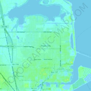
Name: Texas City topographic map, elevation, terrain.
Location: Texas City, Galveston County, Texas, 77590, United States (29.35601 -94.95755 29.43601 -94.87755)
Average elevation: 10 ft
Minimum elevation: -13 ft
Maximum elevation: 46 ft
Galveston County trails, hiking, mountain biking, running and outdoor activities
Make a donation
Gear up for your next adventure:
As an Amazon Associate, this site earns from qualifying purchases at no extra cost to you.