Geolocate

Yorktown topographic map

Click on the map to display elevation.

About this map

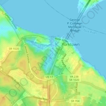
Name: Yorktown topographic map, elevation, terrain.

Location: Yorktown, York County, Virginia, United States (37.22878 -76.52541 37.24255 -76.50458)

Average elevation: 33 ft

Minimum elevation: -3 ft

Maximum elevation: 85 ft

York County trails, hiking, mountain biking, running and outdoor activities

Gear up for your next adventure:

🧥Men's Rain Shells - Premium waterproof and breathable jackets for mountain weather
🧯Portable Fire Pit - Compact fire pit for camping spots
🔥Fast-Boil Camping Stoves - Efficient cooking systems for quick trail meals
🗺️Topographic Maps - Detailed topo maps for hiking, exploring and outdoor navigation
🥾Hiking Shoes - Durable and comfortable shoes for trail hiking

As an Amazon Associate, this site earns from qualifying purchases at no extra cost to you.