Geolocate

Paradise topographic map

Click on the map to display elevation.

About this map

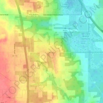
Name: Paradise topographic map, elevation, terrain.

Location: Paradise, Mahoning County, Ohio, 44452, United States (40.95378 -80.72730 40.99378 -80.68730)

Average elevation: 1,096 ft

Minimum elevation: 988 ft

Maximum elevation: 1,214 ft

Mahoning County trails, hiking, mountain biking, running and outdoor activities

Gear up for your next adventure:

🪶Survival Guide Book - Expert advice for emergency preparedness
🧭Pro Hiking Compasses - High-accuracy liquid-filled compasses for topographic orientation
📦Gear Storage Bags - Organize and protect outdoor equipment
😴Insulated Sleeping Pads - Compact and warm pads for high-elevation camping
🪵Folding Camp Saw - Compact saw for wood and campsite work

As an Amazon Associate, this site earns from qualifying purchases at no extra cost to you.