Geolocate

Tangalan topographic map

Click on the map to display elevation.

About this map

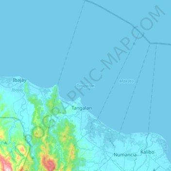
Name: Tangalan topographic map, elevation, terrain.

Location: Tangalan, Aklan, Western Visayas, Philippines (11.67946 122.20030 11.94370 122.35157)

Average elevation: 95 ft

Minimum elevation: -10 ft

Maximum elevation: 2,385 ft

Gear up for your next adventure:

🕶️GPS Smartphone Mount - Secure mount for phone navigation
🦟Ultrasonic Repellers - Create a bug-free zone at your camp or rest stop
🎒Hydration Pack - Hands‑free water reservoir for long hikes
🖼️Topo Map Wall Art - Decorative topographic prints of famous peaks and regions
🛏️Cold Weather Sleeping Bag - Warm sleeping bag for cold conditions

As an Amazon Associate, this site earns from qualifying purchases at no extra cost to you.