Geolocate

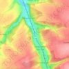
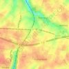
Offranville topographic map

Click on the map to display elevation.

About this map

Name: Offranville topographic map, elevation, terrain.

Location: Offranville, Dieppe, Seine-Maritime, Normandy, Metropolitan France, 76550, France (49.84801 0.99655 49.89383 1.07018)

Average elevation: 240 ft

Minimum elevation: 26 ft

Maximum elevation: 344 ft

Other topographic maps

Click on a map to view its topography, its elevation and its terrain.

Saint-Adrien

France > Normandy > Seine-Maritime > Belbeuf

Average elevation: 184 ft

Puys Beach

France > Normandy > Seine-Maritime > Dieppe > Puys

Average elevation: 98 ft

Le Pollet

France > Normandy > Seine-Maritime > Torcy-le-Petit

Average elevation: 276 ft

Edreville

France > Normandy > Seine-Maritime > Octeville-sur-Mer

Average elevation: 256 ft

La Grand Route

France > Normandy > Seine-Maritime > Écalles-Alix

Average elevation: 482 ft

La Fresnaye

France > Normandy > Seine-Maritime > Buchy

Average elevation: 659 ft

Le Pière

France > Normandy > Seine-Maritime > Étaimpuis

Average elevation: 515 ft

Gear up for your next adventure:

🔭Telescopic Hiking Pole - Adjustable pole for hiking stability
🪶Compact Camp Shovel - Folding shovel for campsite tasks
🕶️Glacier Sunglasses - Side shields to protect eyes from high-altitude snow glare
🔥Camping Stove - Portable stove for camping and backcountry cooking
🔥Plasma Lighters - Windproof lighters that work in any weather condition

As an Amazon Associate, this site earns from qualifying purchases at no extra cost to you.