
Thank you for supporting this site ❤️
Make a donation
Make a donation
Gear up for your next adventure:
As an Amazon Associate, this site earns from qualifying purchases at no extra cost to you.
Ronxar topographic map
Click on the map to display elevation.
Thank you for supporting this site ❤️
Make a donation
Make a donation
Gear up for your next adventure:
As an Amazon Associate, this site earns from qualifying purchases at no extra cost to you.
About this map
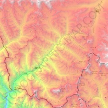
Name: Ronxar topographic map, elevation, terrain.
Location: Ronxar, Tingri County, Shigatse, Tibet, China (27.90594 86.20431 28.31155 86.56777)
Average elevation: 16,411 ft
Minimum elevation: 6,539 ft
Maximum elevation: 23,953 ft
Thank you for supporting this site ❤️
Make a donation
Make a donation
Gear up for your next adventure:
As an Amazon Associate, this site earns from qualifying purchases at no extra cost to you.