
东丰县 topographic map
Interactive map
Click on the map to display elevation.
About this map
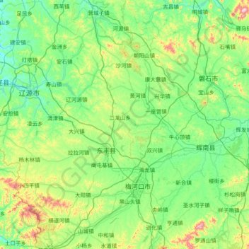
Name: 东丰县 topographic map, elevation, terrain.
Location: 东丰县, 辽源市, 吉林省, 中国 (42.29820 125.04814 43.23087 125.83873)
Average elevation: 1,211 ft
Minimum elevation: 784 ft
Maximum elevation: 3,343 ft
Other topographic maps
Click on a map to view its topography, its elevation and its terrain.