Geolocate

Comuna 3 topographic map

Click on the map to display elevation.

About this map

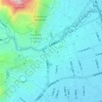
Name: Comuna 3 topographic map, elevation, terrain.

Location: Comuna 3, Cali, Sur, Valle del Cauca, RAP Pacífico, Colombia (3.43863 -76.54892 3.46235 -76.51856)

Average elevation: 3,366 ft

Minimum elevation: 3,153 ft

Maximum elevation: 4,636 ft

Gear up for your next adventure:

🗺️NatGeo Topo Maps - High-quality waterproof printed topographic maps of US Parks
👟Men's Trail Runners - Lightweight footwear for fast-paced exploration and light hiking
👓Polarized Sunglasses - Outdoor sunglasses for glare reduction
🛡️Bear Spray Outdoor - Protection in bear country hikes
🎁Geography Themed Gifts - Unique gift ideas for map lovers and geography enthusiasts

As an Amazon Associate, this site earns from qualifying purchases at no extra cost to you.