Geolocate

Cool Springs topographic map

Click on the map to display elevation.

About this map

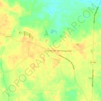
Name: Cool Springs topographic map, elevation, terrain.

Location: Cool Springs, Colquitt County, Georgia, United States (31.20908 -83.62156 31.24908 -83.58156)

Average elevation: 285 ft

Minimum elevation: 223 ft

Maximum elevation: 322 ft

Colquitt County trails, hiking, mountain biking, running and outdoor activities

Other topographic maps

Click on a map to view its topography, its elevation and its terrain.

Funston

United States > Georgia > Colquitt County

Average elevation: 335 ft

Berlin

United States > Georgia > Colquitt County

Average elevation: 233 ft

Ellenton

United States > Georgia > Colquitt County

Average elevation: 253 ft

Norman Park

United States > Georgia > Colquitt County

Average elevation: 328 ft

Gear up for your next adventure:

🧺Microfiber Travel Towels - Compact and fast-drying towels for trail use
🧤Hiking Gloves - Protective gloves for rugged trails
📚USA Hiking Guide Books - Top trail guides and map books
🧯Portable Fire Pit - Compact fire pit for camping spots
💧Water Filtration Bottles - Safely drink from streams and lakes while exploring

As an Amazon Associate, this site earns from qualifying purchases at no extra cost to you.