Geolocate

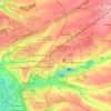
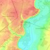
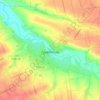
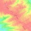
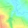
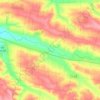
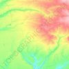
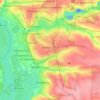
Verbove topographic map

Click on the map to display elevation.

About this map

Name: Verbove topographic map, elevation, terrain.

Location: Verbove, Polohivska urban hromada, Polohy Raion, Zaporizhia Oblast, 70633, Ukraine (47.40821 35.95095 47.44503 36.04349)

Average elevation: 417 ft

Minimum elevation: 272 ft

Maximum elevation: 574 ft

Other topographic maps

Click on a map to view its topography, its elevation and its terrain.

Robotyne

Ukraine > Zaporizhia Oblast

Average elevation: 453 ft

Zaporizhzhia

Ukraine > Zaporizhia Oblast > Zaporizhzhia

The city is located in south-eastern Ukraine. The Dnieper river splits the city for two parts between them is located the Khortytsia island. The city covers 334 km2 at an elevation of 50 m above sea level.

Average elevation: 272 ft
Zaporizhzhia

Ukraine > Zaporizhia Oblast

Zaporizhzhia is located in south-eastern Ukraine. The Dnieper splits the city in two; between them is Khortytsia Island. The city covers 334 km2 (129 sq mi) at an elevation of 50 m (160 ft) above sea level. The New and Old Dnieper flow past around Khortytsia: The New Dnieper [uk] is about 800 m (2,600 feet)…

Average elevation: 256 ft
Tokmak

Ukraine > Zaporizhia Oblast

Average elevation: 210 ft

Orikhiv

Ukraine > Zaporizhia Oblast

Average elevation: 217 ft

Orikhiv

Ukraine > Zaporizhia Oblast

Average elevation: 217 ft

Enerhodar

Ukraine > Zaporizhia Oblast

Average elevation: 72 ft

Ternuvate

Ukraine > Zaporizhia Oblast

Average elevation: 482 ft

Melitopol

Ukraine > Zaporizhia Oblast

Average elevation: 85 ft

Khortytsia

Ukraine > Zaporizhia Oblast

Average elevation: 203 ft

Berdiansk

Ukraine > Zaporizhia Oblast

Average elevation: 20 ft

Stepne rural hromada

Ukraine > Zaporizhia Oblast

Average elevation: 295 ft

Huliaipole

Ukraine > Zaporizhia Oblast

Average elevation: 417 ft

Uspenivka

Ukraine > Zaporizhia Oblast

Average elevation: 374 ft

Huliaipole

Ukraine > Zaporizhia Oblast

Average elevation: 417 ft

Zaporizhzhia

Ukraine > Zaporizhia Oblast

Zaporizhzhia is located in south-eastern Ukraine. The Dnieper splits the city in two; between them is Khortytsia Island. The city covers 334 km2 (129 sq mi) at an elevation of 50 m (160 ft) above sea level. The New and Old Dnieper flow past around Khortytsia: The New Dnieper [uk] is about 800 m (2,600 feet)…

Average elevation: 256 ft
Zaliznychne

Ukraine > Zaporizhia Oblast

Average elevation: 463 ft

Polohy

Ukraine > Zaporizhia Oblast

Average elevation: 449 ft

Zaporizhzhia

Ukraine > Zaporizhia Oblast

Zaporizhzhia is located in south-eastern Ukraine. The Dnieper splits the city in two; between them is Khortytsia Island. The city covers 334 km2 (129 sq mi) at an elevation of 50 m (160 ft) above sea level. The New and Old Dnieper flow past around Khortytsia: The New Dnieper [uk] is about 800 m (2,600 feet)…

Average elevation: 256 ft
Marfopil

Ukraine > Zaporizhia Oblast

Average elevation: 410 ft

Odarivka

Ukraine > Zaporizhia Oblast

Average elevation: 157 ft

Huliaipole

Ukraine > Zaporizhia Oblast

Average elevation: 417 ft

Smile

Ukraine > Zaporizhia Oblast

Average elevation: 587 ft

Zahirne

Ukraine > Zaporizhia Oblast > Zahirne

Average elevation: 407 ft

Solodkovodne

Ukraine > Zaporizhia Oblast

Average elevation: 499 ft

Berdiansk

Ukraine > Zaporizhia Oblast

Average elevation: 20 ft

Gear up for your next adventure:

🌡️Portable Weather Meter - Track weather conditions on the trail
🛡️Insect Repellent - Protection against bugs during outdoor activities
📡GPS Antenna Upgrade - Enhance GPS reception in remote terrain
🪶Wildlife Field Guides - Learn animal tracking and species ID
📱Heavy-Duty Phone Cases - Drop-proof and waterproof protection for outdoor navigation

As an Amazon Associate, this site earns from qualifying purchases at no extra cost to you.