
Thank you for supporting this site ❤️
Make a donation
Make a donation
Gear up for your next adventure:
As an Amazon Associate, this site earns from qualifying purchases at no extra cost to you.
lekia topographic map
Click on the map to display elevation.
Thank you for supporting this site ❤️
Make a donation
Make a donation
Gear up for your next adventure:
As an Amazon Associate, this site earns from qualifying purchases at no extra cost to you.
About this map
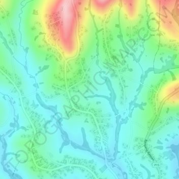
Name: lekia topographic map, elevation, terrain.
Location: lekia, Nkong-Zem, Menoua, West, Cameroon (5.52571 10.11353 5.54571 10.13353)
Average elevation: 5,072 ft
Minimum elevation: 4,882 ft
Maximum elevation: 5,522 ft
Thank you for supporting this site ❤️
Make a donation
Make a donation
Gear up for your next adventure:
As an Amazon Associate, this site earns from qualifying purchases at no extra cost to you.