
Thank you for supporting this site ❤️
Make a donation
Make a donation
Gear up for your next adventure:
As an Amazon Associate, this site earns from qualifying purchases at no extra cost to you.
Mornico topographic map
Click on the map to display elevation.
Thank you for supporting this site ❤️
Make a donation
Make a donation
Gear up for your next adventure:
As an Amazon Associate, this site earns from qualifying purchases at no extra cost to you.
About this map
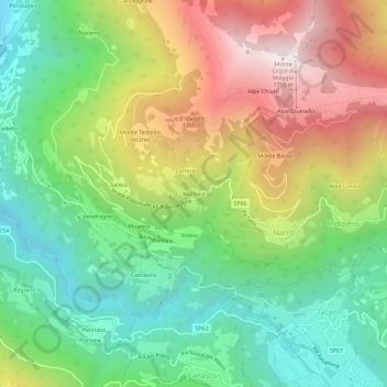
Name: Mornico topographic map, elevation, terrain.
Location: Mornico, Bellano, Lecco, Lombardia, 23822, Italia (46.01668 9.32374 46.05668 9.36374)
Average elevation: 2,943 ft
Minimum elevation: 971 ft
Maximum elevation: 5,866 ft
Thank you for supporting this site ❤️
Make a donation
Make a donation
Gear up for your next adventure:
As an Amazon Associate, this site earns from qualifying purchases at no extra cost to you.