Geolocate

Overberg topographic map

Click on the map to display elevation.

About this map

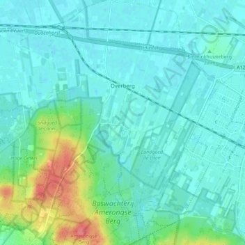
Name: Overberg topographic map, elevation, terrain.

Location: Overberg, Utrechtse Heuvelrug, Utrecht, Netherlands (52.00503 5.47650 52.05732 5.52938)

Average elevation: 56 ft

Minimum elevation: 10 ft

Maximum elevation: 236 ft

Gear up for your next adventure:

🥾Women's Hiking Boots - Top-rated trail boots with ankle support and superior grip
🎒Day Hiking Backpack - Lightweight backpack perfect for day trips and outdoor adventures
💧Water Purification System - Clean water on the trail with reliable purifiers
🍳Camping Cook Set - Complete cookware for outdoor meals
🔭Telescopic Hiking Pole - Adjustable pole for hiking stability

As an Amazon Associate, this site earns from qualifying purchases at no extra cost to you.