
Aloha topographic map
Click on the map to display elevation.
About this map
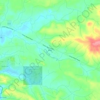
Name: Aloha topographic map, elevation, terrain.
Average elevation: 102 ft
Minimum elevation: 3 ft
Maximum elevation: 312 ft
Grays Harbor County trails, hiking, mountain biking, running and outdoor activities
Other topographic maps
Click on a map to view its topography, its elevation and its terrain.
Chehalis Village
United States > Washington > Grays Harbor County > Chehalis Village
Average elevation: 138 ft
North Fork West Branch Wynoochee River
United States > Washington > Grays Harbor County
Average elevation: 2,746 ft
Pacific Beach
United States > Washington > Grays Harbor County > Pacific Beach
Average elevation: 62 ft