
Thank you for supporting this site ❤️
Make a donation
Make a donation
Gear up for your next adventure:
As an Amazon Associate, this site earns from qualifying purchases at no extra cost to you.
Egg topographic map
Click on the map to display elevation.
Thank you for supporting this site ❤️
Make a donation
Make a donation
Gear up for your next adventure:
As an Amazon Associate, this site earns from qualifying purchases at no extra cost to you.
About this map
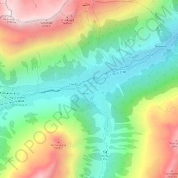
Name: Egg topographic map, elevation, terrain.
Location: Egg, Galtür, Bezirk Landeck, 6563, Autriche (46.94729 10.16562 46.98729 10.20562)
Average elevation: 6,581 ft
Minimum elevation: 4,997 ft
Maximum elevation: 9,104 ft
Thank you for supporting this site ❤️
Make a donation
Make a donation
Gear up for your next adventure:
As an Amazon Associate, this site earns from qualifying purchases at no extra cost to you.