Geolocate

Bangkilingan topographic map

Click on the map to display elevation.

About this map

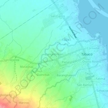
Name: Bangkilingan topographic map, elevation, terrain.

Location: Bangkilingan, Tabaco, Albay, Bicol Region, 4511, Philippines (13.33931 123.69771 13.37931 123.73771)

Average elevation: 66 ft

Minimum elevation: -3 ft

Maximum elevation: 279 ft

Gear up for your next adventure:

🧭Orienteering Set - Complete compass and map reading kit
🧣Merino Neck Gaiters - Multi-functional headwear for wind and sun protection
📚USA Hiking Guide Books - Top trail guides and map books
🎁Geography Themed Gifts - Unique gift ideas for map lovers and geography enthusiasts
🌡️Handheld Weather Meters - Measure wind, temp, and pressure for safe mountain travel

As an Amazon Associate, this site earns from qualifying purchases at no extra cost to you.