
Brühlervorstadt topographic map
Interactive map
Click on the map to display elevation.
About this map
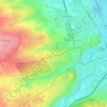
Name: Brühlervorstadt topographic map, elevation, terrain.
Location: Brühlervorstadt, Erfurt, Thuringia, 99092, Germany (50.95984 10.97134 50.98897 11.02566)
Average elevation: 787 ft
Minimum elevation: 620 ft
Maximum elevation: 1,020 ft
Other topographic maps
Click on a map to view its topography, its elevation and its terrain.
Niedernissa
Germany > Thuringia > Erfurt > Niedernissa
Niedernissa, Erfurt, Thuringia, 99099, Germany
Average elevation: 925 ft